HELP US BUILD DONNER LAKE RIM TRAIL SOUTH
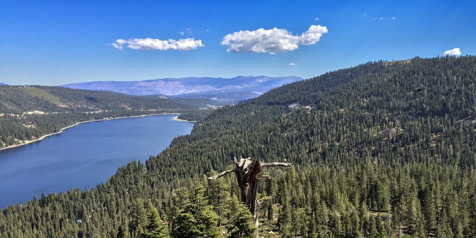
Looking east along Schallenberger Ridge, the planned route of Donner Lake Rim Trail.
Donner Lake Rim Trail South
The Donner Lake Rim Trail is an in-progress trail project planned to encircle Donner Lake, along peaks and ridgelines, eventually adding up to more than 23 miles. Your support will help us raise the needed $435,000 towards this $1,000,000 project.
Current sections connect from Castle Valley on Donner Summit to Northwoods Boulevard in Truckee. Trailheads at Castle Valley, Glacier Way, Bermgarten Road, and a connection via the Wendin Way Trail offer a variety of access points. Ready to hit the trail? Click here.
Truckee Donner Land Trust begins construction in 2025 on the southern stretch of the Donner Lake Rim Trail, running from Coldstream Canyon in the east to Donner Summit in the West. Beginning at the JP Trail, this new 12 to 15 mile segment of the Donner Lake Rim Trail continues along the crest of Schallenberger Ridge with views of Donner Lake on one side, and the granite cliffs of Coldstream Canyon along the Sierra Crest on the other. Crossing Lakeview Canyon, the trail climbs Mount Judah through Sugar Bowl and over to our Royal Gorge open space. This adds to the 12 miles of Donner Lake Rim Trail already completed on the north side, with a goal of a more than 23-mile long route around the lake. This cornerstone trail project has been a part of the Land Trust’s mission since the beginning, and brings together partners including California State Parks, the US Forest Service, Placer County, Sugar Bowl Resort, and our local trail nonprofits.
Key Benefits
Conservation: A well-planned and constructed trail has great conservation value. Strategically increasing publicly available trails disburses the growing number of users in our area, reducing impacts on the land and wildlife. As the Land Trust encourages more people to get out out on protected lands and trails, we can also help raise awareness of conservation and stewardship.
Recreation: Along with the recreation benefits of the new trail open for walking, riding, and running, the trail will further enhance connectivity throughout the region. The new trail is a part of Placer County’s Memorial Overland Emigrant Trail, planned to one day reach all the way to Auburn! It also links to planned trails in Coldstream Canyon, the Pacific Crest Trail, and the Land Trust’s Royal Gorge Trails. As part of the north half of the Donner Lake Rim Trail, it will lead to the Hole in the Ground Trail, the planned Pines to Mines Trail stretching all the way to Nevada City, and Tahoe Donner’s trail network in the Euer Valley.
Your gift of $1,000 or more will be recognized on Donner Lake Rim Trail trailhead kiosks.
Donate to Donner Lake Rim Trail South HERE
Budget
Placer County has granted $565,000, but Truckee Donner Land Trust needs an additional $435,000 to complete this $1,000,000 project.


