FROG LAKE, RED MOUNTAIN & CARPENTER RIDGE
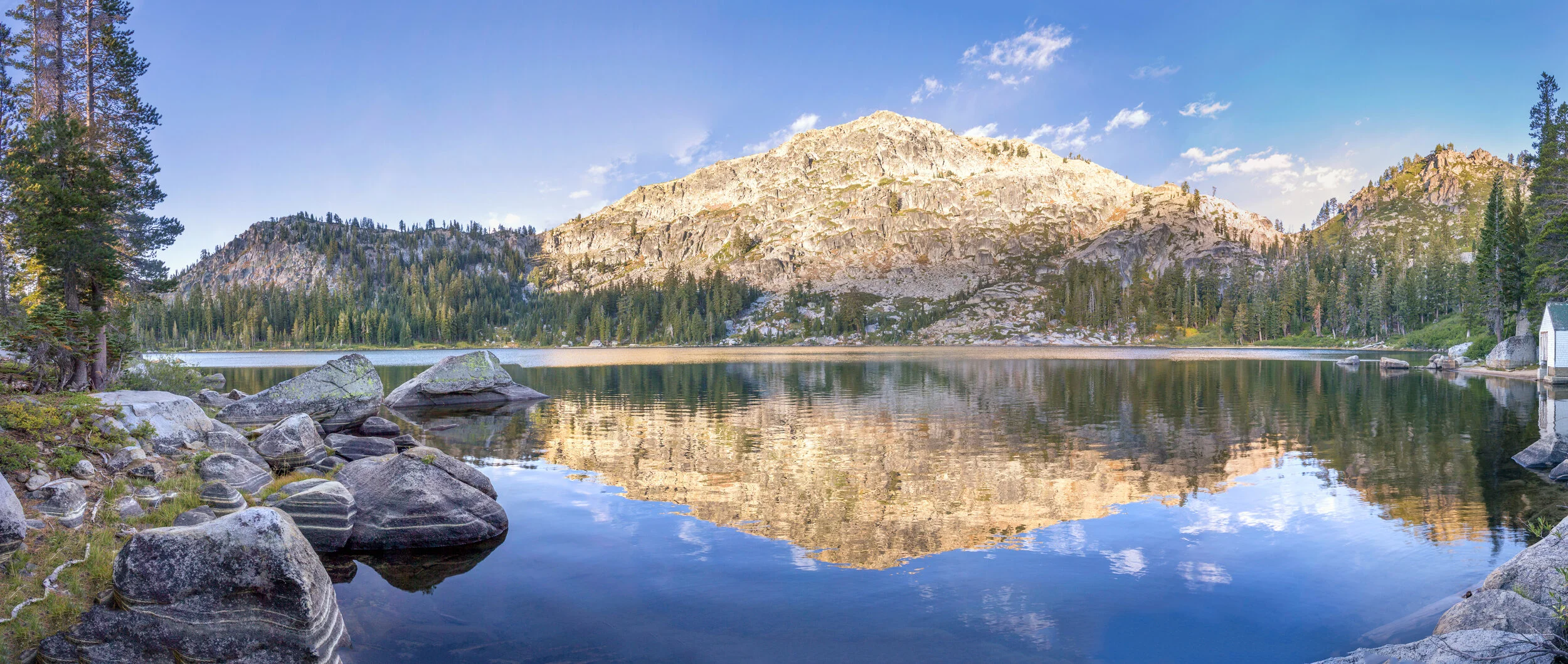
Frog Lake at sunrise, photo by Elizabeth Carmel
Winter 2024-15 reservations open July 19 at 8 a.m.
In June 2020 Truckee Donner Land Trust and its partners at the Northern Sierra Partnership – the Trust for Public Land and The Nature Conservancy – purchased Frog Lake, Red Mountain & Carpenter Ridge. This $15 million deal wouldn’t have been possible without the support of donors like you. The spectacular crystal-clear lake framed by 1,000-foot-high cliffs, Red Mountain looking down on Euer Valley and Carpenter Valley, and Carpenter Ridge between Carpenter Valley and Independence Lake all add up to nearly 3,000 acres of newly protected open space, building on past successes to help protect that watershed and open up new recreation opportunities for the public.
As climate change and development threaten northern Sierra wildlife, migration corridors become increasingly important. These new acquisitions multiply the conservation benefits of nearby Land Trust projects, creating larger swaths of protected land for deer, bear, bobcats, coyotes, birds and other species.
These lands also protect multiple forks of the Prosser Creek watershed – a major tributary of the Truckee River, while also protecting the springs that feed the unique fens and their rare species in Lower Carpenter Valley below.
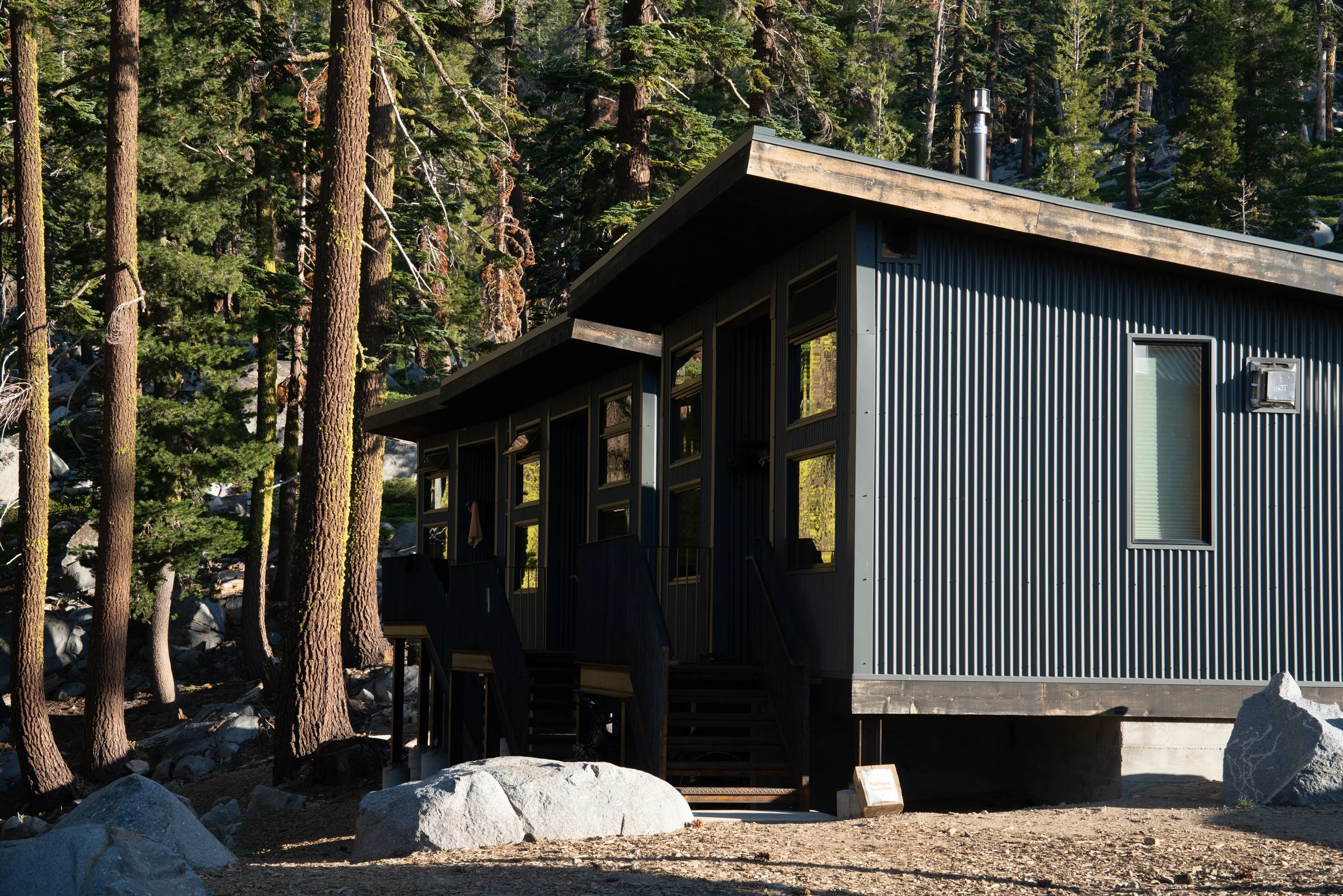
The huts in summer, photo by Helen Pelster.
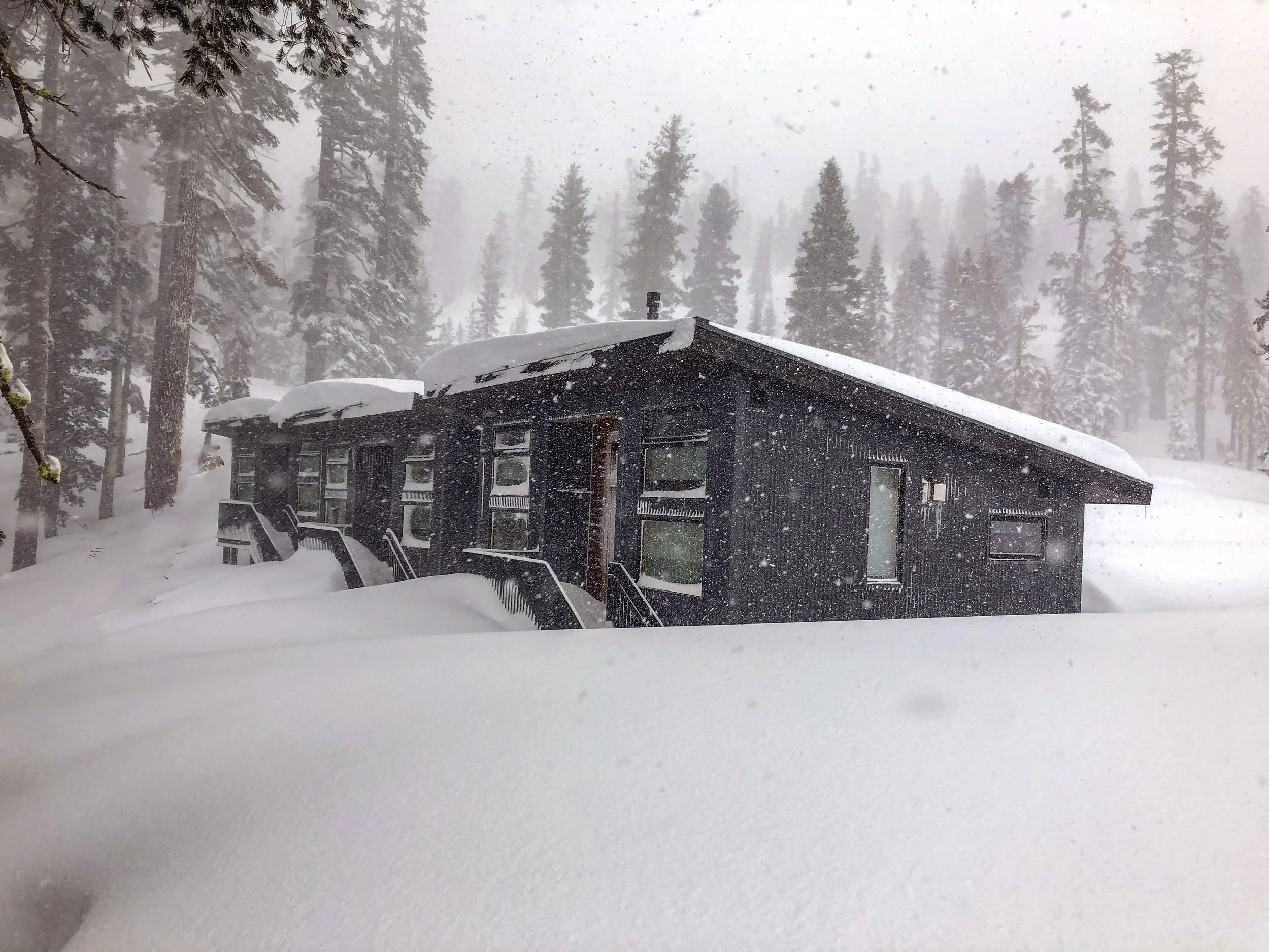
The huts in winter.
field notes
COOL FACTOR
Frog Lake was closed to the public for roughly 100 years, owned privately by the Smith Family and kept in pristine condition. The properties contain beautiful late-seral stands of red fir. Frog Lake is reputed to have big brook trout, standard fishing regulations of the Sierra District California Department of Fish and Wildlife apply.
WHAT TO DO
Hiking, biking, running and swimming are available in the summer months, while backcountry skiing, snowboarding and snowshoeing will be popular in the winter.
Hiking, biking, running: Currently Frog Lake is accessible by climbing the Warren Lake Trail off of the Donner Lake Rim Trail to the top of Frog Lake Cliff, where the Red Dot Trail goes down along the northern rim of Frog Lake, eventually reaching its eastern shore. Future trails are planned that will connect over Red Mountain to the east of Frog Lake, dropping down to Lower Carpenter Valley to join the recently built Lower Carpenter Valley nature trail.
From Castle Valley Trailhead (6.5 miles one way): Take the Donner Lake Rim Trail east to the Warren Lake Trail. Near the top of Frog Lake Cliff, follow the Red Dot Trail to the north and down to Frog Lake.
From Pacific Crest Trailhead (5.5 miles one way): Take the connector trail from the PCT trailhead near Boreal to the Pacific Crest Trail, where it crosses under Interstate 80. Turn right on the Summit Lake Trail, and cross the Donner Lake Rim Trail to continue on the Warren Lake Trail. Near the top of Frog Lake Cliff, follow the Red Dot Trail to the north and down to Frog Lake.
WINTER ROUTES:
Winter Use: Frog Lake and its surrounding peaks and ridges offer incredible backcountry skiing and snowboarding terrain. All areas are uncontrolled avalanche terrain that require appropriate avalanche education and equipment. Click here to learn more about available ski routes, safety and other information.
Castle Peak Trailhead (3.5 miles one way, 1,500 feet gain, 1,100 descent)
This route begins at the Castle Peak Snowpark located on Boreal Ridge Road off of Interstate 80. A Snowpark permit is required for parking at this location, which can be purchased at several area outdoor stores.
Starting from Castle Valley Road head north for a short distance before turning east in the Castle Valley Meadow toward Castle Creek, where there may be an open water crossing depending on conditions. Continue on rolling terrain north, ultimately gaining an open broad ridge that leads up to the farthest Castle Peak pinnacle to the east of the true peak. Continue east along the ridge from Castle Peak to Frog Lake Cliff.
Terrain gets steep and complex at this point with numerous avalanche hazards. The most straightforward route heads north at Frog Lake Cliff, wrapping around the northern ridge of Frog Lake with different options generally getting easier the farther west you go to the low saddle in the ridge. Pick the best option for avalanche conditions and your abilities and head down to the lake.
Johnson Canyon Trailhead (4.5 miles one way, 1,900 feet gain, 650 feet descent)
Our Wendin Way Trailhead in the summer, Johnson Canyon offers a mostly below treeline option following the route of a dirt road up the canyon toward Summit Lake to the west. A notch in the terrain at about 2 miles in allows you to continue north, contouring the upper headwaters of the South Fork of Prosser Creek. You’ll see the steep south-southeast slopes that gain the ridge accessing Frog Lake on the other side. Contour east and then climb the Southeast-east aspects of Frog Lake Basin to reach Frog Lake.
Huts: Truckee Donner Land Trust has three sleeping huts and one communal hut with kitchen for cooking, available for reservation year-round. The Albert M Rockwood Bunkhouse, Ted R. Hut and Morgan Family Hut will offer overnight accommodations with heating and running cold and hot water for groups of different sizes, while the renovated Eschenbach Stone House - hewn from local granite in the 1930s - will include a kitchen, map room and other areas for socializing at the end of the day. Learn more about the huts and make a reservation here.
RULES, REGULATIONS, GOOD TO KNOW
Frog Lake, Red Mountain and Carpenter Ridge are open to the public from dawn to dusk for day use. Camping, fires, and motorized vehicles are prohibited on the property. Dogs must be under voice command on the property and not allowed in the huts. Pets must not endanger wildlife. Drones are not allowed without express written permission from Truckee Donner Land Trust on any Land Trust properties - click here to learn more.


