
FROG LAKE
WINTER NAVIGATION & SAFETY
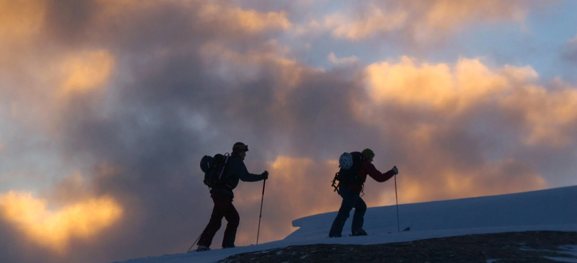
Photo by Bill Stevenson
This page describes winter over snow routes, avalanche hazard conditions, and more. To learn about summer access, click here.
The Frog Lake Backcountry Huts are set in a remote backcountry setting – making them both rewarding and challenging to access.
Accessing the Frog Lake Backcountry Huts in winter usually takes between two to five hours depending on your route, the fitness of your group, your group’s route finding abilities and, of course, weather and conditions.
During the snowy months, access to Frog Lake is via several routes. Detailed route descriptions and identified hazards can be found below. Regardless of your route, it’s not uncommon for your tour to the hut, especially your first time, to take longer than expected. Be prepared to spend the night out if you don’t make it; winter days are short.
All the winter routes highlighted in this guide require some backcountry skills and experience along with avalanche education. Basic navigation and route-finding skills will also be needed to follow the described routes. Winter backcountry travel can present many challenges and dangers.
Conditions can and will vary greatly from season to season and day to day in our mountain environment. All precautions and planning should be done before setting off on a trip to Frog Lake.
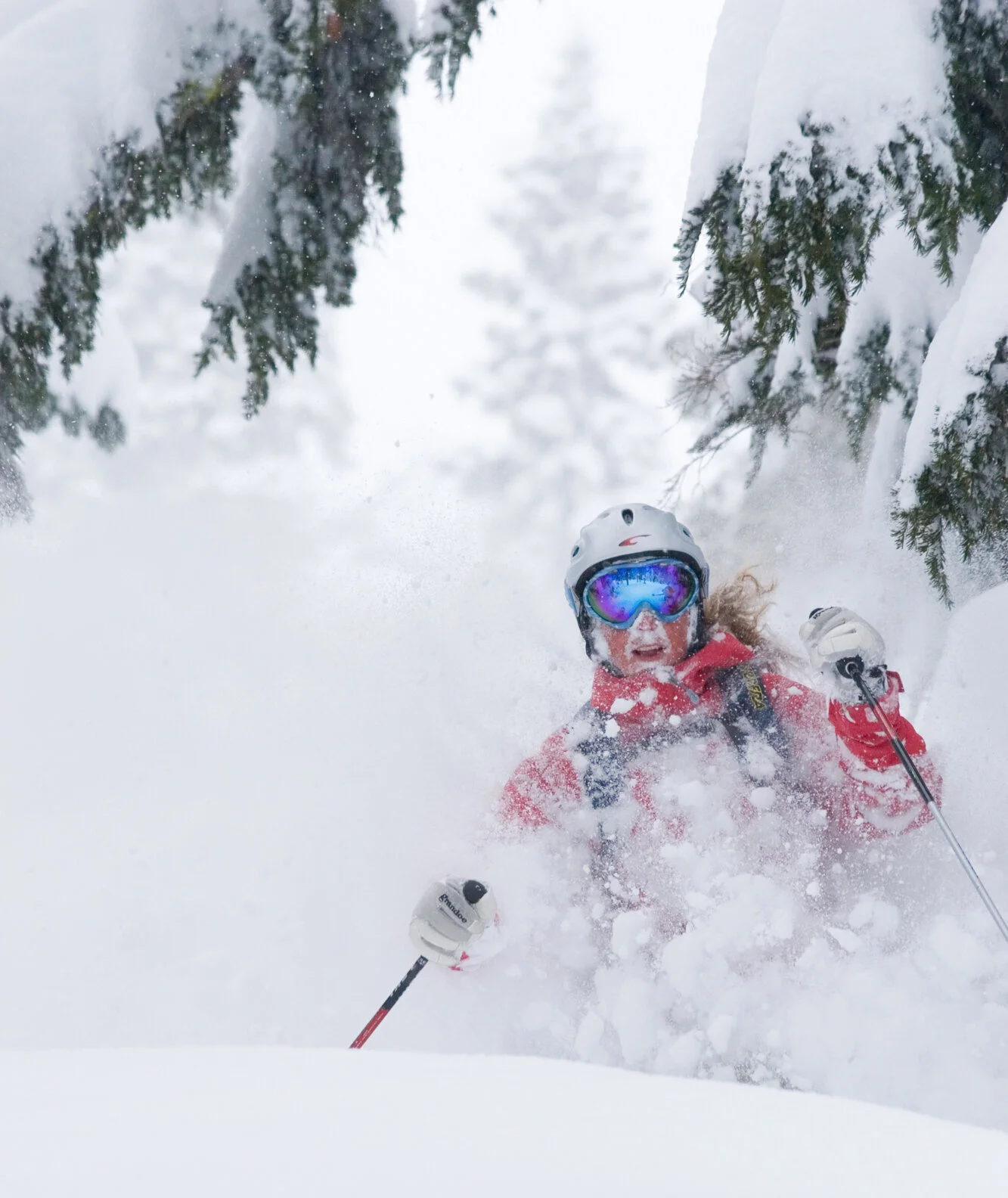
Photo by Bill Stevenson
Ways to get to frog lake

Hiking out of Frog Lake. Photo by Blair Porteous
ROUTE SUMMARIES
Avalanche Terrain
All the routes listed in this guide have some degree of avalanche hazard. Avalanche terrain is rated on the Avalanche Terrain Exposure Scale (ATES) for each of the route descriptions. These ratings, along with the daily avalanche forecast, should aid users to pick appropriate timing and routes based on current conditions.
Castle Peak Trailhead (3.5 miles one way, 1,500 feet gain, 1,100 descent)
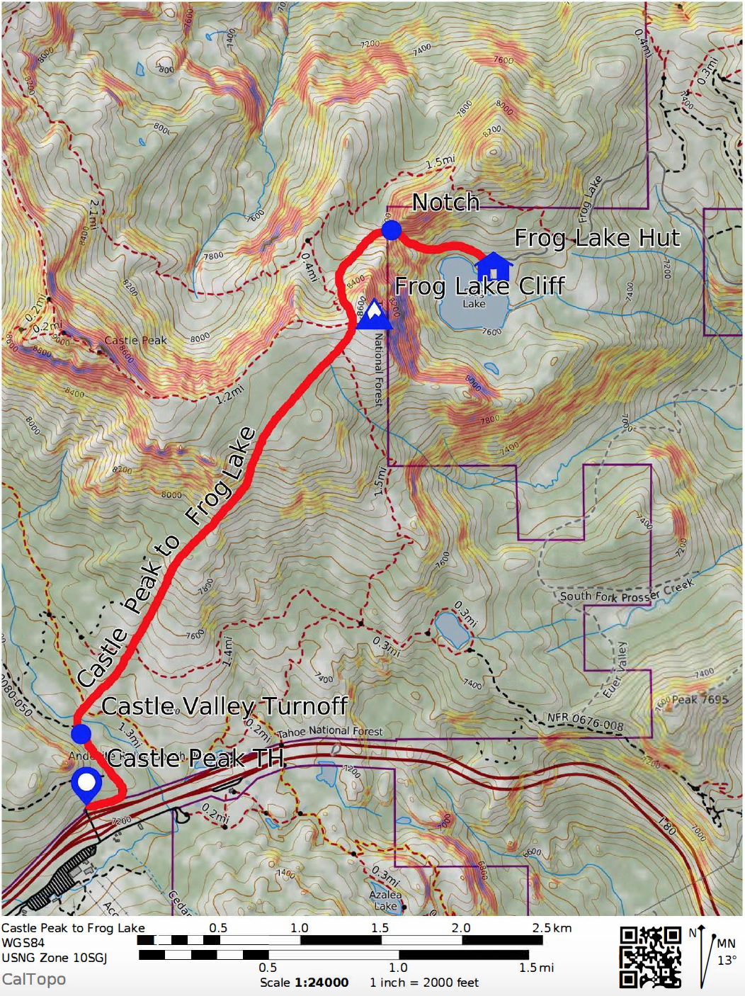
This route begins at the Donner Summit Sno-Park located on Boreal Ridge Road off of Interstate 80. A Sno-Park permit is required for parking at this location, which can be purchased at several area outdoor stores.
Starting from Castle Peak Road head north for a short distance before turning east in the Castle Valley Meadow toward Castle Creek, where there may be an open water crossing depending on conditions. Continue on rolling terrain north, ultimately gaining an open broad ridge that leads up to the farthest Castle Peak pinnacle to the east of the true peak. Continue east along the ridge from Castle Peak to Frog Lake Cliff.
Terrain gets steep and complex at this point with numerous avalanche hazards. The most straightforward route heads north at Frog Lake Cliff, wrapping around the northern ridge of Frog Lake with different options generally getting easier the farther west you go to the low saddle in the ridge. Pick the best option for avalanche conditions and your abilities and head down to the lake.
-
Castle Peak Trailhead 7240’, Lat/Long: 39.3401, -120.3502
3 ½ miles one way with 1500’ of elevation gain and 1100’ of elevation descent. Avalanche Terrain Exposure Scale: Complex This route begins at the Castle Peak Snowpark located on Boreal Ridge Road on Donner Summit. A CA snowpark permit is required for parking at this location which can be purchase at several outdoor stores or online. This route offers near treeline high elevation travel with complex terrain options and should only be attempted by experienced backcountry users with appropriate avalanche conditions. Start at Castle Valley road and follow for a short distance before turning off into the large Castle Valley meadow to Castle Creek. Crossing Castle Creek could encounter open water and may be challenging to find a suitable crossing especially in late spring conditions. Move through treed rolling terrain while heading north, ultimately gaining an open broad ridge which leads up to the furthest Castle Peak pinnacle to the East of the true peak. As you near the base of this rock ridge, contour towards the east side in open bowled terrain. At the top of the bowl, the route will continue toward the top of Frog Lake Cliffs on gentle rolling terrain.
Up to this point, the terrain is easy to negotiate with little avalanche terrain if you remain on route. As you near the top of Frog Lake Cliffs, the terrain turns complex from this point down to the hut with multiple overlapping avalanche paths and terrain traps. It is imperative that you have appropriate avalanche conditions to move through this terrain. Large corniced ridgelines are common on the top of Frog Lake Cliffs and adjacent ridges and should be avoided. Poor visibility during storms could severely impede traveling through this terrain safely. The most straightforward route to the hut splits the steep NW side of Frog Lake Cliffs and a short steep avalanche path to the west. There are also additional small and short avalanche paths that are scattered lower in this drainage as you descend to the notch.
Once you reach the prominent notch, descend a gully down towards Frog Lake. The gully is steep, at around 40 degrees at the top, and flanked by additional avalanche terrain on both sides on E-SE-S aspects in near and below treeline terrain. Some of this avalanche terrain is commonly wind loaded along with large cornices on the ridges. Once through the steeper part of the gully and over a bench in the terrain, traverse towards the hut.
Johnson Canyon Trailhead (4.5 miles one way, 1,900 feet gain, 650 feet descent)
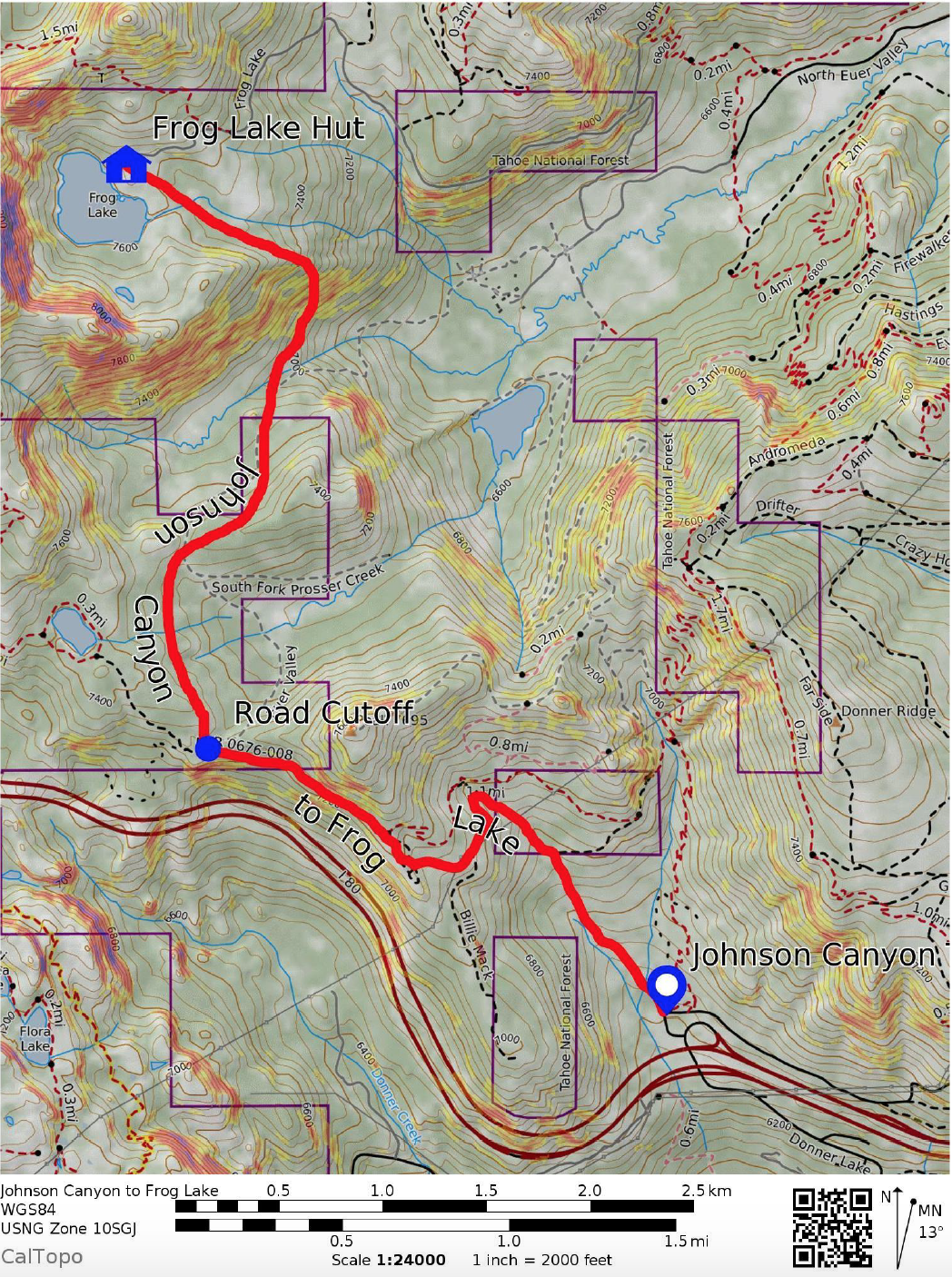
Our Wendin Way Trailhead in the summer, Johnson Canyon offers a mostly below treeline option following the route of a dirt road up the canyon toward Summit Lake to the west. A notch in the terrain at about 2 miles in allows you to continue north, contouring the upper headwaters of the South Fork of Prosser Creek. You’ll see the steep south-southeast slopes that gain the ridge accessing Frog Lake on the other side. Contour east and then climb the Southeast-east aspects of Frog Lake Basin to reach Frog Lake. NOTE: there isn’t a regular plowing/maintenance schedule for parking at Johnson Canyon, park at your own risk.
-
Johnson Canyon Trailhead 6400’, Lat/Long: 39.3332, -120.2910
4 ½ miles one way with 1900’ in elevation gain and 650’ in elevation descent.
Avalanche Terrain Exposure Scale: Simple Take the Donner Lake Exit on Interstate 80, about halfway between Donner Summit and Truckee. At the bottom of the off ramp, head North (uphill) about 300 yards to the trailhead where there is a large parking area. The Johnson Canyon route consists of mostly easy below treeline terrain and starts off on an existing summertime dirt road that leads up the main canyon on mostly low angle terrain. You will pass to the south of peak 7695’ and continue along the snow-covered road towards Summit Lake which parallels Interstate 80. You will reach a notch in the terrain where another summertime access road heads north at just over the 2-mile mark. At this point, you will head north and start to contour the upper headwaters of the South Fork of Prosser Creek. Treed and rolling terrain will open as you near the creek.
You will begin to see the steep S-SE slopes that gain the ridge with the Frog Lake Basin on the other side. Continue downslope near the creek, to around 7000’ before contouring up and around on to SE/E aspects which will provide the lowest angle route to move through this terrain. Isolated small areas of avalanche terrain could be encountered through this section, but with careful route finding, most all avalanche terrain can be avoided with limited exposure. Once the ridge is gained, rolling terrain will lead you to the Frog Lake Hut.
Donner Summit Rest Area (3 miles one way, 1,450 feet gain, 1,050 feet descent)
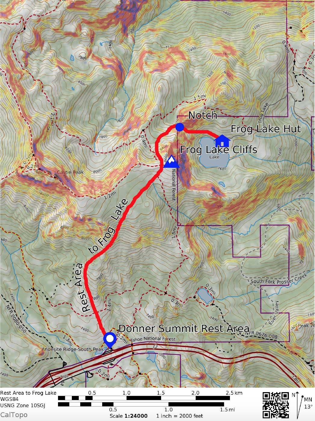
Parking at the Westbound Donner Summit Highway Rest Area is subject to California Highway Patrol regulations, so check on acceptable duration for leaving your vehicle, or get dropped off, if using this option. No overnight parking is permitted.
Head north toward Castle Peak, contouring east to gain the ridge before reaching Castle Peak itself. Follow Castle Peak’s east ridge to the east to reach Frog Lake Cliff. The route down is the same as the Castle Valley route listed above.
-
Donner Summit Rest Area Trailhead 7240’, Lat/Long: 39.3429, -120.3400
3 miles one way, with 1450’ of elevation gain and 1050’ of elevation descent
Avalanche Terrain Exposure Scale: Complex Begin at the Donner Summit Highway Rest Area on the West Bound side of Interstate Highway I-80. There is no long-term parking here and this trailhead is for a drop off starting point only. This route offers near treeline high elevation travel with complex terrain options and should only be attempted by experienced backcountry users with appropriate avalanche conditions. Behind the rest area, head up through spaced treed terrain and large granite outcroppings to a broad ridge. This will join the route from the Castle Peak Snowpark Trailhead in this area. Move through treed rolling terrain while heading north, ultimately gaining an open broad ridge which leads up to the furthest Castle Peak pinnacle to the East of the true peak. As you near the base of this rock ridge, contour towards the east side in open bowled terrain. At the top of the bowl the route will continue toward the top of Frog Lake Cliffs on gentle rolling terrain.
Up to this point, the terrain is easy to negotiate with little avalanche terrain if you remain on route. As you near the top of Frog Lake Cliffs, the terrain turns complex from this point down to the hut with multiple overlapping avalanche paths and terrain traps. It is imperative that you have appropriate avalanche conditions to move through this terrain. Large corniced ridgelines are common on the top of Frog Lake Cliffs and adjacent ridges and should be avoided. Poor visibility during storms could severely impede traveling through this terrain safely. The most straightforward route to the hut splits the steep NW side of Frog Lake Cliffs and a short steep avalanche path with a corniced ridge to the west. There are also additional small and short avalanche paths that are scattered lower in this drainage as you descend to the notch.
Once you reach the prominent notch, descend a gully down towards Frog Lake. The gully is steep, at around 40 degrees at the top, and flanked by additional avalanche terrain on both sides on E-SE-S aspects in near and below treeline terrain. Some of this avalanche terrain is commonly wind loaded along with large cornices on the ridges. Once through the steeper part of the gully and over a bench in the terrain, traverse towards the hut.
Please Do Not Trespass on Neighboring Private Property:
Locating the Huts in the Frog Lake Basin:


Photo by Bill Stevenson
Snow safety
Frog Lake Huts are located in areas of known avalanche terrain with recurring avalanche cycles. Routes starting from the Interstate 80 West Bound Rest Stop, Donner Summit Sno-Park at Castle Valley and Johnson Canyon are not marked or maintained. Tracks from other groups are not reliable as they may become snow covered, melt out or may not lead to Frog Lake.
Winter wilderness travel is not to be taken lightly – all visitors must understand people die every year in the backcountry. Truckee Donner Land Trust strongly suggests that visitors are experienced in evaluating avalanche conditions, snow stability, hazards, and in practicing prudent safety and navigation techniques. At a minimum, all members of a party should have Level 1 avalanche training and carry a beacon, probe and shovel. Backcountry equipment can be rented from a variety of outdoor gear stores in Truckee.
GUIDEs
If you have any concerns about safety or navigation in visiting the backcountry huts, hire a guide. You’ll gain valuable skills from the experience. Guides can accompany you on the way in, or stay for the entire visit (the Land Trust can provide limited accommodations for guides). Truckee Donner Land Trust has partnered with experienced guide services:
North American Ski Training & Climbing
Alpenglow Expeditions
Alpine Skills International
Tahoe Mountain School
Blackbird Mountain Guides (Also offering gear/food porter services)
Backcountry Babes
New for 2022/23: trailhead shuttle
Dirt Gypsy Adventures
Shuttles allow visitors to start from trailheads that do not allow overnight parking
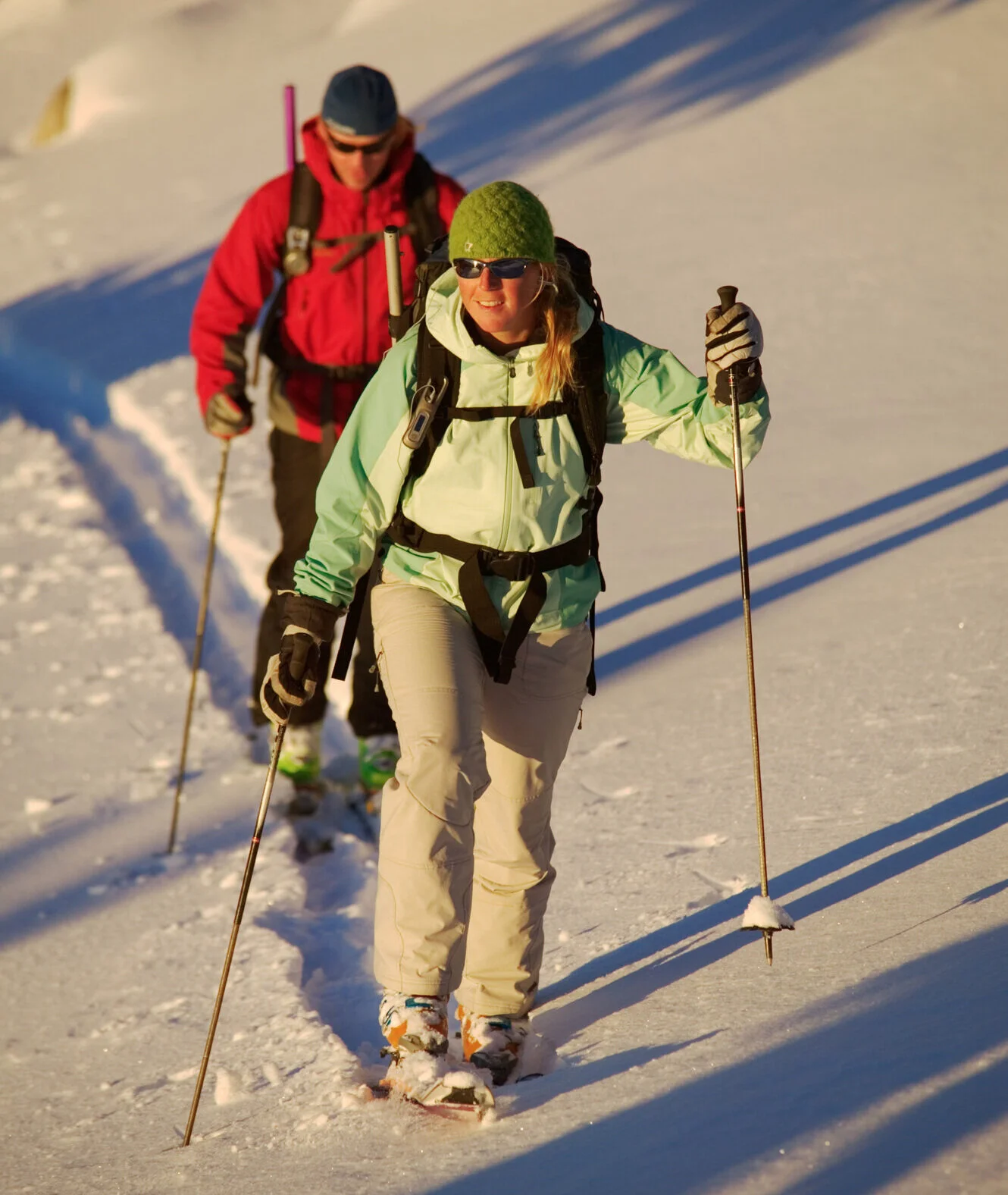
Photo by Bill Stevenson
Before you go, read and study the local avalanche forecast.
Truckee Donner Land Trust recommends visitors begin checking the Sierra Avalanche Center website regularly before your trip to get a feel for conditions. Study maps to your route to see what type of terrain and aspects you will be traveling through, and consider the avalanche forecast’s implication for that route. Develop alternative routes in case conditions deteriorate. It is up to each visitor to make an informed decision based on conditions whether or not to go.

Photo by Bill Stevenson